

Farming is the oldest activity known to humans. Since ancient times, farmers have grown crops and raised animals to produce food to sustain their lives. Farming has rapidly become one of the most important sectors which provide food to all human beings.
Over the centuries, with continuous global population growth, farming has evolved with the abundant use of fertilizers, pesticides, water, and simple farm machinery in order to produce enough food for the masses. But unfortunately, all this has led to less productive fields and environmental pollution while malnutrition remains the biggest global problem.
In aiming to produce enough food and remain sustainable, farming has been faced with significant changes. In the new agricultural era, farmers are able to use various high-tech sensing devices based on GPS, variable rate application, steering systems and remote sensing, as well as farming software. The introduction and use of modern and precise farm technologies not only brings revolutionary changes into farming but also has revolutionized the way in which farmers work.
By using precise technology, farmers are able to optimize both farm productivity and profitability based on real-time field information thus protecting the environment. Moreover, this technology may be the turning point to success.
What Are Drones?
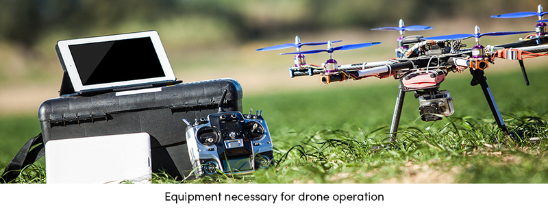
Unmanned aerial vehicles (UAV), commonly named drones, are small aerial platforms weighing up to 20 kg (50 lbs). Due to their size, they cannot be boarded by a human body (yet). Drones can be operated in two ways; directly, in which a human has complete control of the vehicle by wireless remote; and autonomously, in which the vehicle is able to control itself and follow a route based on data from GPS or other sensors.
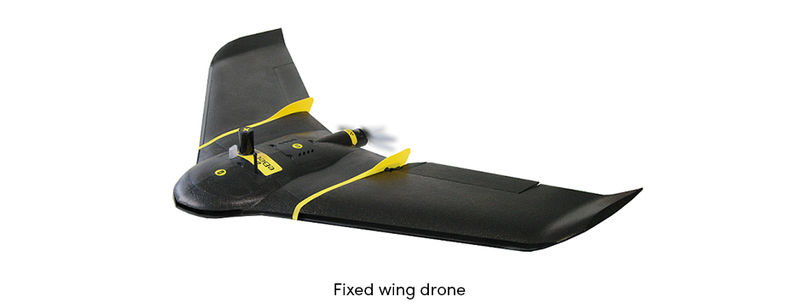
There are many different kinds of unmanned aerial vehicles and can be categorized into the following groups: fixed wing, rotary wing, lighter-than-air (LTA), and tethered.
- Fixed wing is a very simple vehicle to control. It has some form of a non-movable wing and a propeller that facilitates forward movement. Due to its construction, it must always be moving relative to the air around it to stay aloft. Hence, it’s operation can be greatly affected by the wind. Another limiting factor is that larger drones require some kind of runway area that can be used for deployment and retrieval, while smaller ones can be hand launched and retrieved by landing on a soft surface.
- Rotary wing is the most common drone type. It looks like a small helicopter since it has multiple rotors (typically 4-8). Due to its rotary system, it has the ability to hover and can be vertically deployed and retrieved. The rotary wing vehicle has some advantages over other types. It is small and easily transportable and less liable to mechanical failure. The main disadvantages, though, are its limitation in cargo it can carry as well as its battery life, which is limited to allowing only 15 minutes or less of flight.
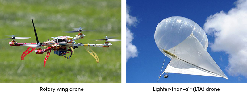
- Lighter-than-air (LTA) vehicles include blimps and other typical helium-filled crafts tethered to some kind of wire. Its main disadvantages are their difficulty transporting because of size, and the fact that they cannot tolerate even moderate wind speeds. Therefore, LTA drones are used less in farming.
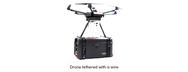
- Tethered vehicle is a common drone tethered to a wire to eliminate the need for a remote controller. Drone movement is therefore confined according to the tether. Moreover, tethered drones have many different variations. They can range from a standard drone moved according to the tether to a drone tethered with a microfilament wire with installed power system for unlimited flight.
Drone Role in Agriculture
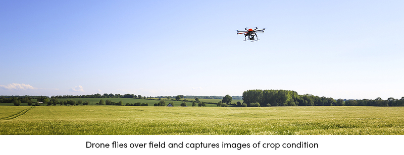
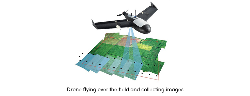
Drones are small and light aerial vehicles which may fly at extremely high altitudes and carry various navigation systems or recording devices such as RGB cameras, infrared cameras, and other sensors. Due to their ability to deploy various sensors and capture high-resolution and low-cost images of crop conditions, drones are very useful in farming.
Initially used for chemical spraying, today drones are a great tool for capturing aerial imagery with platform mounted cameras and sensors. Images can range from simple visible-light photographs to multi-spectral imagery that can be used to assess different aspects of plant health, weeds, and assets.
Drones collect raw data and translate it with algorithms into useful information. Therefore, they can be used for various applications in farming, such as the monitoring of the following parameters:
- Crop health – damage made by pests, color change due to pest infection
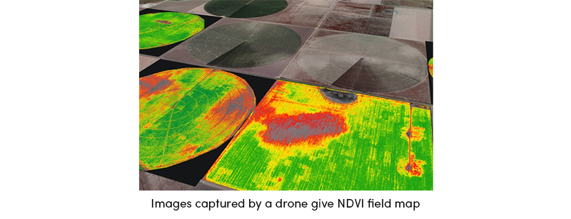
- Vegetation indices – leaf area, anomaly detection, treatment efficacy, phenology, yield
- Plant height - plant height and density
- Plant counting – plant size, plot statistics, stand number, compromised plots, planter skips
- Water needs – water stressed parts of the field/orchard, need for watering
- Soil analysis – nutrient availability for plant nutrient management
To summarize, drones help farmers optimize the use of inputs such as seeds, fertilizers, water, and pesticides more efficiently. This allows for the timely protection of crops from pests, saving time for crop scouting, saving overall cost in farm production, and securing a high and healthy yield.
-
From Raw Data to Useful Information
-
Flying over the field, the drone takes high-resolution pictures with a camera or sensor. Based on a measured parameter, these images are captured in different bands from visible (color), near-infrared to infrared spectrum. The collected images are raw data which requires further interpretation. Immediately after capturing the image, the images are directly sent to the cloud/software where different prescription maps are created depending on the operation the farmer wants to perform on the field. The maps can then be uploaded on the specific farm equipment which will adjust the amount of inputs (seeds, fertilizers, pesticides) that would need to be applied to the field accordingly.
-
In the era of precision farming, drones are acting as an essential technology that will take farming to a completely new level. They are a cost-effective way to collect data about various crop conditions in a relatively short period of time. Drones have also shown great potential in the ability to provide sustainable farming, improve yield, and increase overall farm profitability.
Technology in farming is constantly evolving. Collecting accurate and reliable georeferenced data based on GPS coordinates and automated steering systems, along with the use of remote sensing (drones), is an essential part of precision farming which can optimize both farm productivity and profitability.
Although there are some risks and limitations, precision farming and related technology have great potential in dealing with the challenges of a modern farm production and at the same time protecting natural resources.
Text sources: Agrivi


")
Comments (1)
Login or Register to add a comment